


10 GREEN, Noble County, Indiana
About
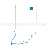
Outline

Summary
| Unique Area Identifier | 579938 |
| Name | 10 GREEN |
| County | Noble County |
| State | Indiana |
| Area (square miles) | 36.03 |
| Land Area (square miles) | 35.67 |
| Water Area (square miles) | 0.37 |
| % of Land Area | 98.98 |
| % of Water Area | 1.02 |
| Latitude of the Internal Point | 41.30119040 |
| Longtitude of the Internal Point | -85.37485300 |
Maps


Graphs
Select a template below for downloading or customizing gragh for 10 GREEN, Noble County, Indiana


Neighbors
Neighoring Voting District (by Name) Neighboring Voting District on the Map
- 08 YORK, Noble County, IN
- 09 NOBLE, Noble County, IN
- 11 JEFFERSON, Noble County, IN
- 25 ALLEN_AVILLA, Noble County, IN
- 27 SWAN, Noble County, IN
- 29 NOBLE, Noble County, IN
- EEL RIVER B, Allen County, IN
- SMITH EAST, Whitley County, IN
- SMITH NORTHEAST, Whitley County, IN
- SMITH NORTHWEST, Whitley County, IN
- SMITH WEST, Whitley County, IN
- THORNCREEK NORTHEAST, Whitley County, IN
Top 10 Neighboring County Subdivision (by Population) Neighboring County Subdivision on the Map
- Allen township, Noble County, IN (7,134)
- Smith township, Whitley County, IN (5,327)
- Thorncreek township, Whitley County, IN (4,166)
- Eel River township, Allen County, IN (3,612)
- Noble township, Noble County, IN (3,094)
- Swan township, Noble County, IN (2,399)
- Green township, Noble County, IN (2,123)
- York township, Noble County, IN (1,605)
- Jefferson township, Noble County, IN (1,604)
Top 10 Neighboring Place (by Population) Neighboring Place on the Map
Top 10 Neighboring Unified School District (by Population) Neighboring Unified School District on the Map
- Northwest Allen County Schools, IN (35,071)
- East Noble School Corporation, IN (23,175)
- Whitley County Consolidated Schools, IN (22,836)
- Central Noble Community School Corporation, IN (8,759)
- Smith-Green Community Schools, IN (7,423)
Top 10 Neighboring State Legislative District Lower Chamber (by Population) Neighboring State Legislative District Lower Chamber on the Map
Top 10 Neighboring State Legislative District Upper Chamber (by Population) Neighboring State Legislative District Upper Chamber on the Map
Top 10 Neighboring 111th Congressional District (by Population) Neighboring 111th Congressional District on the Map
Top 10 Neighboring Census Tract (by Population) Neighboring Census Tract on the Map
- Census Tract 9725, Noble County, IN (6,511)
- Census Tract 501, Whitley County, IN (5,271)
- Census Tract 9724, Noble County, IN (5,067)
- Census Tract 9726, Noble County, IN (4,222)
- Census Tract 104, Allen County, IN (3,612)